Stuttgarter hut
This very easy mountain hike leads you through untouched valley basins and across mountain crests with beautiful views.
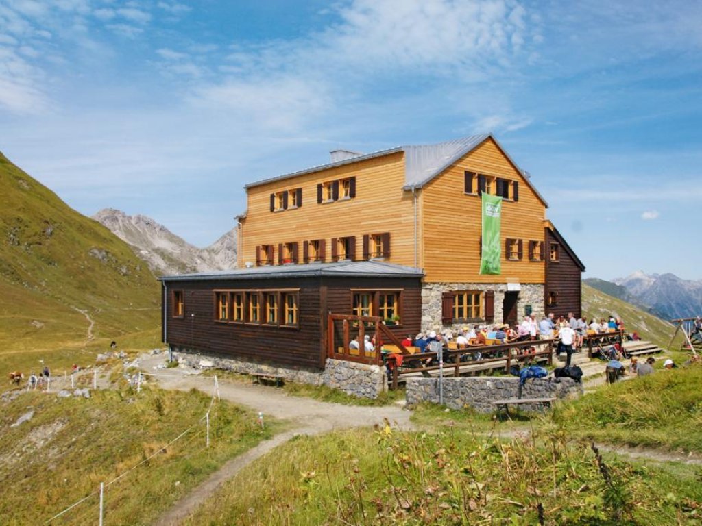
From the starting point Rüfiplatz you go to the Rüfikopf cable car and with the gondola directly up to the Rüfikopf. Now it goes the alp way down to the signpost, here you take the way left uphill on a yoke. Steep downhill to the Ochsengümpel. From here turn right until you reach the Rauhekopfscharte at a fork in the road on the right. You will reach the Stuttgarter Hütte, where you can stop and rest. Now you go downhill and reach the torrent and soon the Paziel valley. You continue to the Trittalpe and soon you reach a goods path that leads you downhill to Zürs. Continuing downhill past the mountain church you reach the main road from where the free blue hiking bus takes you back to Lech.
Directions
From the hike starting point at the Rüfiplatz you reach the Rüfikopfbahn cable car. Take the cable car up the (1) Rüfikopf (2,350m). From here, take the wide alpine path downhill until you reach a signpost. Take the hiking trail to the left uphill to a pass. Continue along a relatively steep path with hairpins going downhill to a saddle. Follow the path downhill to the valley floor of the (2) Ochsengümple. Follow the trail to the right to the very end of the valley. There are no more significant changes in altitude after this. From here, the trail becomes a little steeper going uphill until you reach a junction. Turn right going uphill to the (3) Rauhekopfscharte. Then continue gently downhill to the (4) Stuttgarter hut. After a bite to eat, follow the trail going steadily downhill until you reach a mountain torrent. The trail continues quite steeply downhill to the valley floor of the (5) Pazüeltal.From here, the path continues in a gentle downward slope to the Trittalpe. Continuealong a supply road gently downhill until you reach a paved back road in Zürs am Arlberg. Follow the road, continuing downhill past the (6) mountain church, until you reach the main road. The hiking bus will take you back to the starting point from there.
Suggestions
Special features: From the Bockbach saddle, you can enjoy a gorgeous view of the Allgäuer Alpen all the way to the Zugspitze.
Sights: Bergkirche Zürs – this mountain church is a religious building of several storeys towers above visitors like a castle. And, like a donjon, the three-storey tower symbolizes the significance of the church, which is additionally marked with a red cross.
Refreshment stops: Panorama restaurant Rüfikopf, Stuttgarter hut and restaurants in Lech am Arlberg.
Best time of year
Equipment
Good footwear (ankle high, profile sole), rain protection, Lech Card and bus timetable.
Safety information
EMERGENCY CALL:
140 Alpine Emergencies Austria-wide
144 Alpine Notfälle Vorarlberg
112 Euro emergency call (works with any mobile phone/network)
www.vorarlberg.travel/sicherheitstipps
Public transport
By train to Langen am Arlberg station or St. Anton am Arlberg. From there, buses (No. 750+760) run regularly to Lech Zürs am Arlberg.
Tour facts
- Data source
- vcloud, ID 2ed66ef0-4ab1-467c-934b-d994d3cb5658
- Last updated
- 04.05.2024, 01:05:01

